Why ocean monitoring is changing faster than ships can
A familiar pattern plays out every field season: ship time is limited, weather windows close quickly, and the questions keep multiplying. Meanwhile, the ocean is changing on timescales that don’t wait for a cruise plan—marine heatwaves, hypoxia events, harmful algal blooms, and fast-moving fronts can form and dissipate in days or hours. Ship-based surveys still deliver gold-standard measurements and hands-on calibration, but they struggle to provide persistent coverage across wide areas.
Autonomous platforms are filling that gap by staying out longer, sampling more often, and returning data while conditions are unfolding rather than after the fact. The autonomy shifts effort from deck operations to systems engineering—power budgets, communications dropouts, sensor drift, and recovery logistics become the new bottlenecks, and they can erase gains if not planned for.
What counts as “autonomous” offshore—and what doesn’t
It helps to separate “uncrewed” from truly “autonomous.” A surface drone that follows preplanned waypoints while a pilot watches its track is still doing valuable work, but it is closer to remote operations than to hands-off monitoring. At the other end are platforms that can adapt within guardrails—gliders that adjust dive patterns to conserve energy, moorings that change sampling rates during a bloom, or profiling floats that alter surfacing intervals when communications are poor.
Autonomy offshore also isn’t the same as independence. Most systems rely on intermittent satellite links, forecast inputs, and periodic servicing to swap batteries, clean biofouling, and validate sensors against reference methods. If a project plan assumes “set and forget,” the first hard lesson is usually operational: an autonomous platform can reduce ship days, but it rarely eliminates vessel support, spares, and trained people on standby.
Choosing the right platform: coverage, endurance, and resolution trade-offs
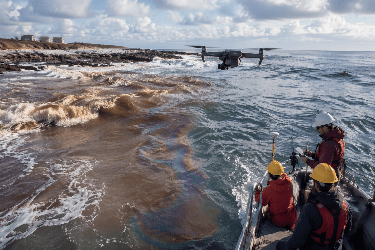
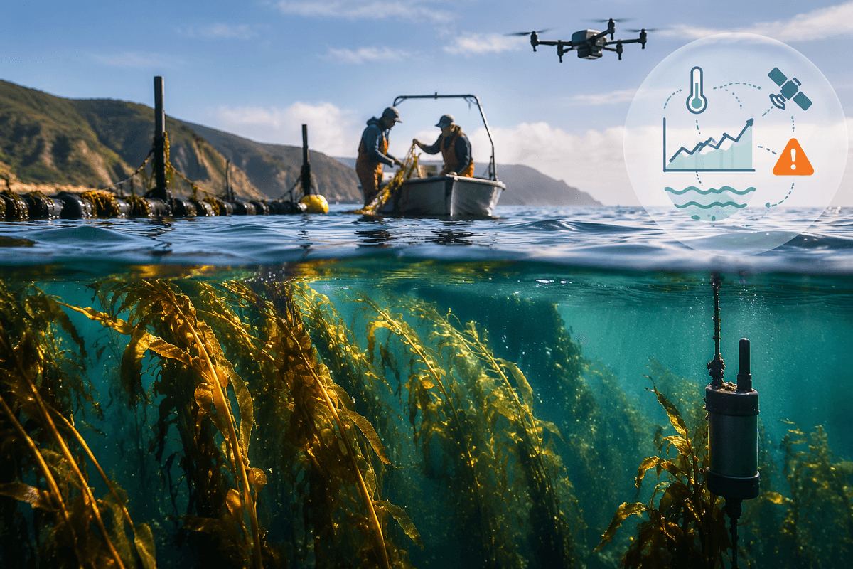
The platform choice usually starts with a simple tension: do you need a wide-area map, a long time series, or fine-scale detail at a specific place? A small aerial drone can give sharp imagery of a shoreline plume or surface slick, but it is limited by battery life, aviation rules, and sea-state constraints at launch and recovery. A wave glider or saildrone can cover large distances for weeks to months and carry meteorological and surface sensors, yet it may miss what is happening below the mixed layer unless paired with profilers or occasional ship casts. Underwater gliders trade speed for endurance, sampling across fronts and shelf breaks with good vertical structure, but they cannot “chase” fast events and can be hard to recover in busy shipping lanes.
Higher-frequency sampling, higher-power sensors, and more telemetry push up energy demand, cost, and failure risk, so matching the platform to the decision you need to make matters more than maximizing specifications.
Sensors and sampling: what autonomy measures well—and what’s still hard
A typical autonomous payload does best with sensors that are compact, low-power, and easy to interpret without a technician standing over the data stream. CTD-class measurements (temperature, conductivity/salinity, pressure), dissolved oxygen, chlorophyll fluorescence, turbidity/backscatter, and surface meteorology are now routine on many platforms, and they gain value from repetition: frequent profiles and long time series make short-lived events visible. Autonomy is also strong at “context” sampling—tracking fronts, logging wave and wind forcing, or mapping broad gradients that guide where ship-based sampling should concentrate.
What remains hard is anything that needs careful handling, stable reagents, or lab-grade cleanliness. Nutrients, carbonate chemistry (high-accuracy pH/TA), eDNA, and many toxin measurements often still require discrete samples, preservation, and bench analysis. Even when in situ analyzers exist, they bring real costs: higher power draw, reagent limits, biofouling risk, and more frequent calibration checks to separate real change from sensor drift.
From raw telemetry to useful decisions: data quality and integration
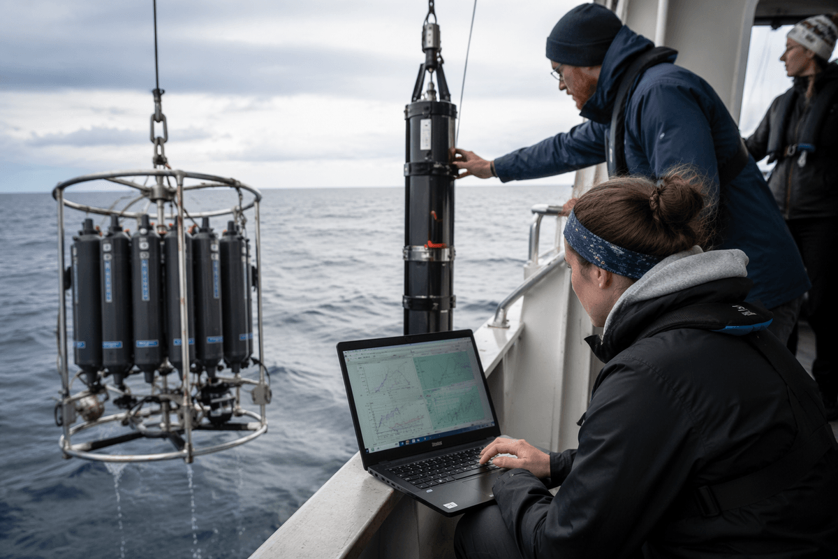
The common surprise with autonomous monitoring is how quickly “more data” turns into “more ambiguity.” Telemetry arrives with gaps, clock drift, changing sensor response after cleaning, and occasional spikes from bubbles, biofouling, or a platform briefly out of the water. If those artifacts are not flagged consistently, the same time series can support two different stories—an apparent hypoxia event that is really a fouled oxygen optode, or a chlorophyll jump caused by a shallow pitch change that moved the sensor into surface foam.
Useful decisions come from treating QA/QC and integration as first-class deliverables, not afterthoughts. Projects that work well define calibration checks against ship casts or fixed references, standardize metadata (location, depth, sampling mode, firmware), and automate basic plausibility tests before data hit dashboards. The practical constraint is cost and staffing: building a reliable pipeline, plus maintaining sensor comparability across platforms and vendors, can take as much effort as the deployment itself, but it is what turns autonomy into trusted evidence.
Operational realities: permits, safety, storms, and maintenance cycles
The coastal manager might be ready to deploy a glider or a small surface vehicle and still lose weeks to paperwork and coordination. Permits can involve protected species rules, marine sanctuaries, aviation restrictions for launch sites, and navigation requirements such as lights, AIS, and marking plans. In busy coastal corridors, the safety case is as important as the sensor list: collision risk, entanglement hazards, and clear recovery procedures matter to port authorities, fishers, and insurers.
Weather is the other hard limiter. Storms and high sea states can halt launches, force early recovery, or push a vehicle off its intended track, and “ride it out” strategies usually trade data quality for survival. Maintenance cycles are rarely optional: biofouling, battery replacement, consumables for wet-chem sensors, and periodic cross-checks against ship casts set the true cadence. Planning for spares, bench time, and a realistic service interval often determines whether autonomy reduces ship days or simply shifts them.
Getting started without overbuilding: pilots that scale responsibly
A practical way to start is to design a pilot around one decision you already struggle to make with ship surveys: early warning for hypoxia, a weekly map of a river plume, or storm-driven sediment pulses. Pick a platform and a small sensor set that can survive missed comms and imperfect weather windows, and budget for “ground truth” (a few ship casts, fixed stations, or lab samples) so you can quantify bias and drift instead of debating it later.
Scale only after you can answer two questions with evidence: how many usable data days you actually got, and what it cost in staff time, servicing, spares, and rework. Most overbuilding comes from treating a first deployment like an operational network; pilots work better when they are instrumented to measure reliability and failure modes, not just the ocean.